sunsetatlas.ch App Store Google Play Instagram
Why I made it
I love camping, and one of the best things about it is watching a beautiful sunset out in nature, listening to the birds and enjoying the view. But here in Switzerland, with all the mountains and forests, I was spending way too much time looking for a spot with a good sunset, because a few trees or another mountain can block the view completely.
So with my background in programming, I looked into whether I could find the data to do the calculations myself. From there, the project got a little out of hand.
“From every point on the map I drew lines to measure how much of the western sky you can see.” Het Nieuwsblad, 4 August 2026 (translated from Dutch)
How it works
A good sunset needs two things: a place where you can actually see the sun go down, and a sky that lights up. Sunset Atlas gives each one its own score from 0 to 100.
The sunset score
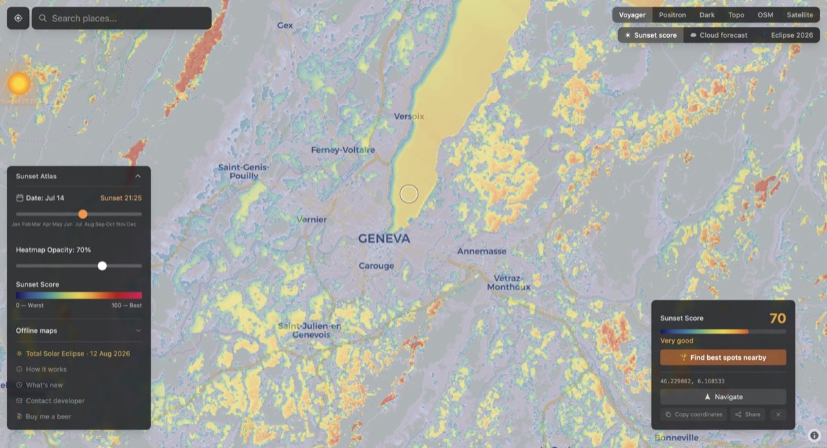
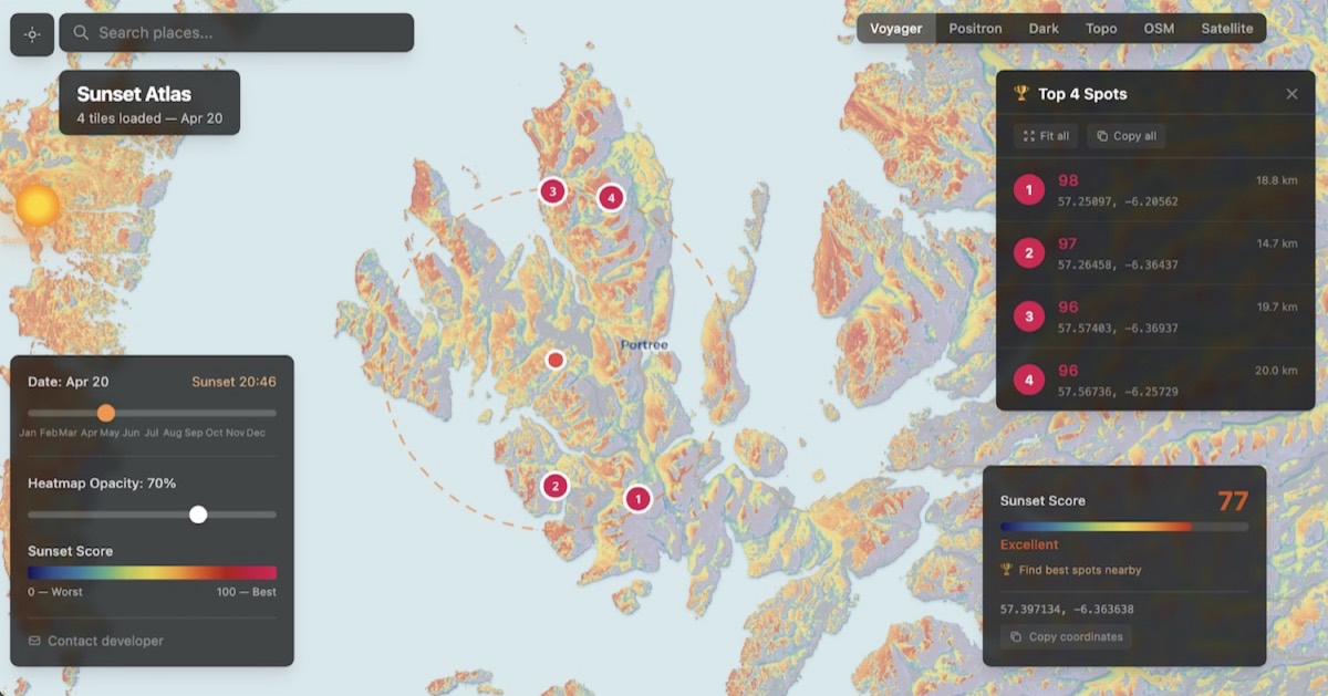
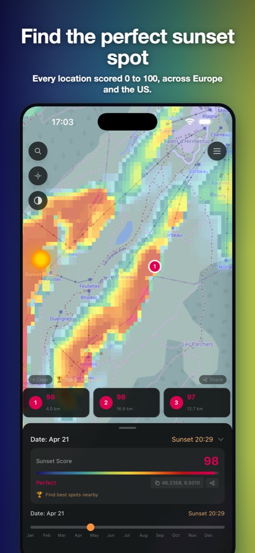
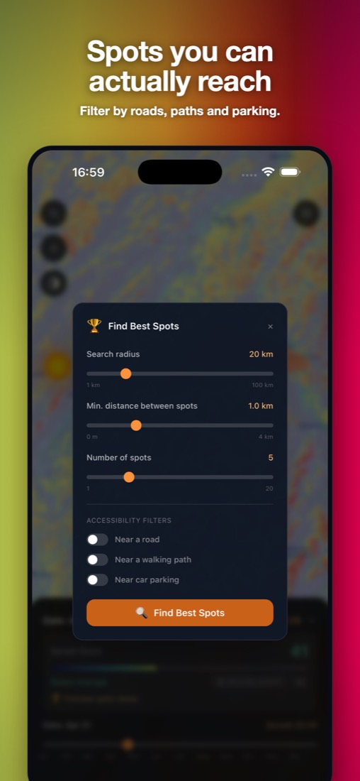
This one is about the place. Tap anywhere on the map and you get its score for the date you choose, because the sun sets further south in winter and further north in summer. The most useful button is “Find best spots nearby”: it ranks the best viewpoints around you, and you can ask for spots close to a road, a walking path or a car park.
Behind it is a Python pipeline that I run ahead of time. It takes a 30 m elevation model and, for every point, casts rays towards the sunset to check whether the terrain rises above the sun. It does that for 24 sunset directions to cover the whole year. Satellite data on land cover and tree height then removes spots hidden by forest, and water, cliffs and west-facing slopes push the good spots higher. The result is cut into map tiles, stored on Cloudflare, and drawn in the browser by a background worker so the map stays smooth on a phone.
The sky score
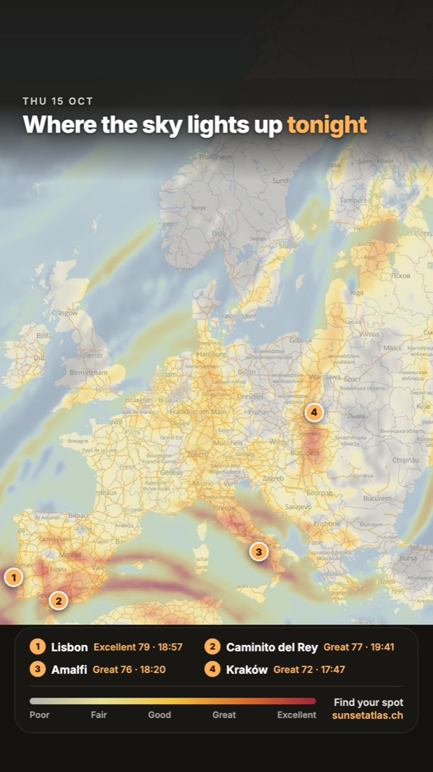
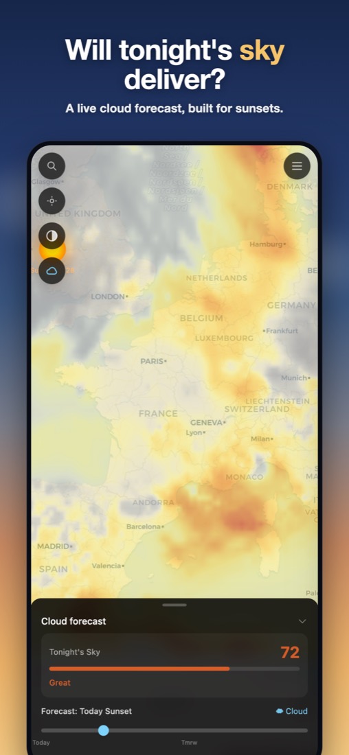
This one is about tonight's weather. The colours of a sunset come from mid and high clouds that are still lit from below after the sun has gone down. Low cloud, or a thick layer of cloud far off towards the sun, takes that light away. The map shows a forecast for tonight and tomorrow, and you can combine it with the sunset score.
Twice a day a scheduled job downloads the latest NOAA weather forecast, with cloud and humidity at 13 heights over Europe. For each place, a small model follows the last rays of the sun through those clouds and works out how much lit cloud you'd see. I keep every forecast and rate the sunsets I see myself, so I can check how far off it was and keep improving it.
The apps
There's an iPhone and an Android app as well. They use the same code as the website, wrapped with Capacitor, and add the things you need outside: maps you can download for when you lose signal in the mountains, directions in your usual navigation app, and sharing a spot with friends.
Getting the word out
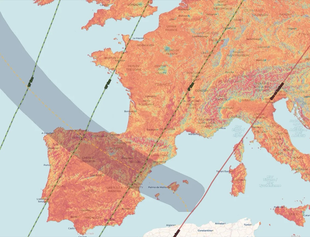
The solar eclipse of 12 August 2026 happened at sunset in most of Europe, with the sun already low in the west. That made the question Sunset Atlas answers suddenly very relevant, so I added an eclipse map with the path of totality and the timing for every place, and promoted it in the weeks before.
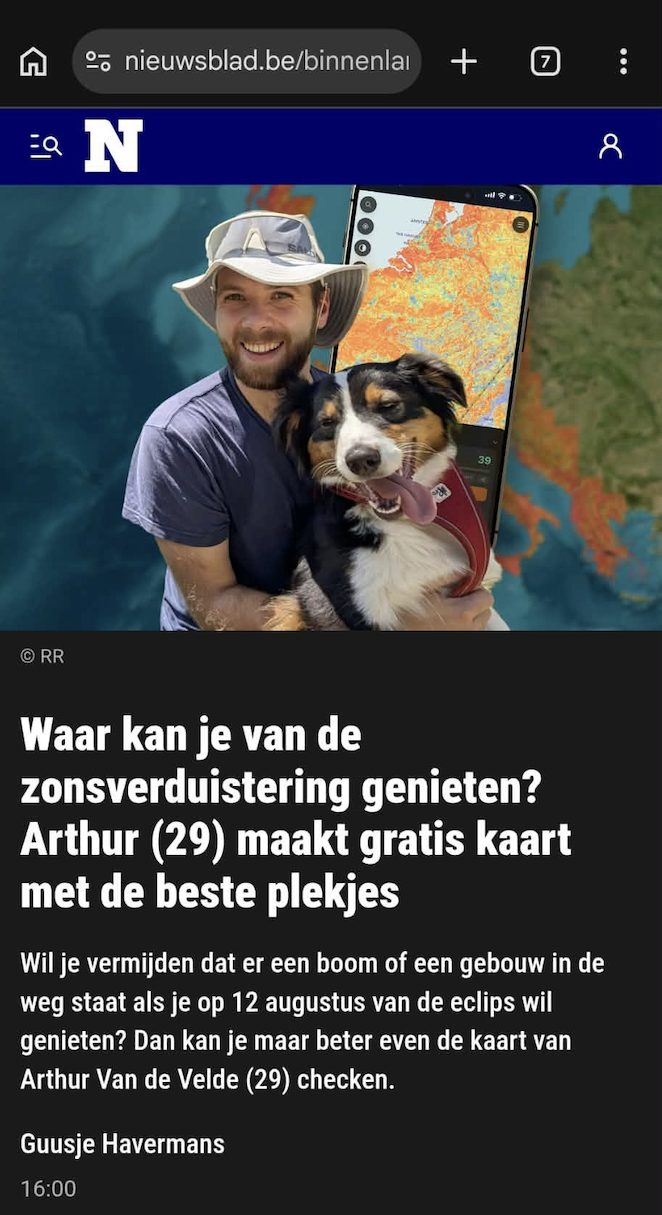
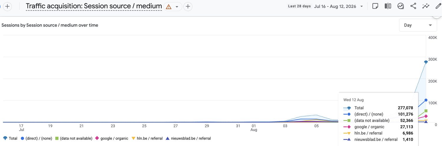
It was picked up by Het Nieuwsblad, one of the biggest newspapers in Belgium, as well as HLN and GVA, Diario de León in Spain, and the Tribune de Genève, Le Nouvelliste and the Anzeiger von Saanen in Switzerland. iPhone downloads went from a few a day to around two hundred, and passed 4,000 by 12 August.
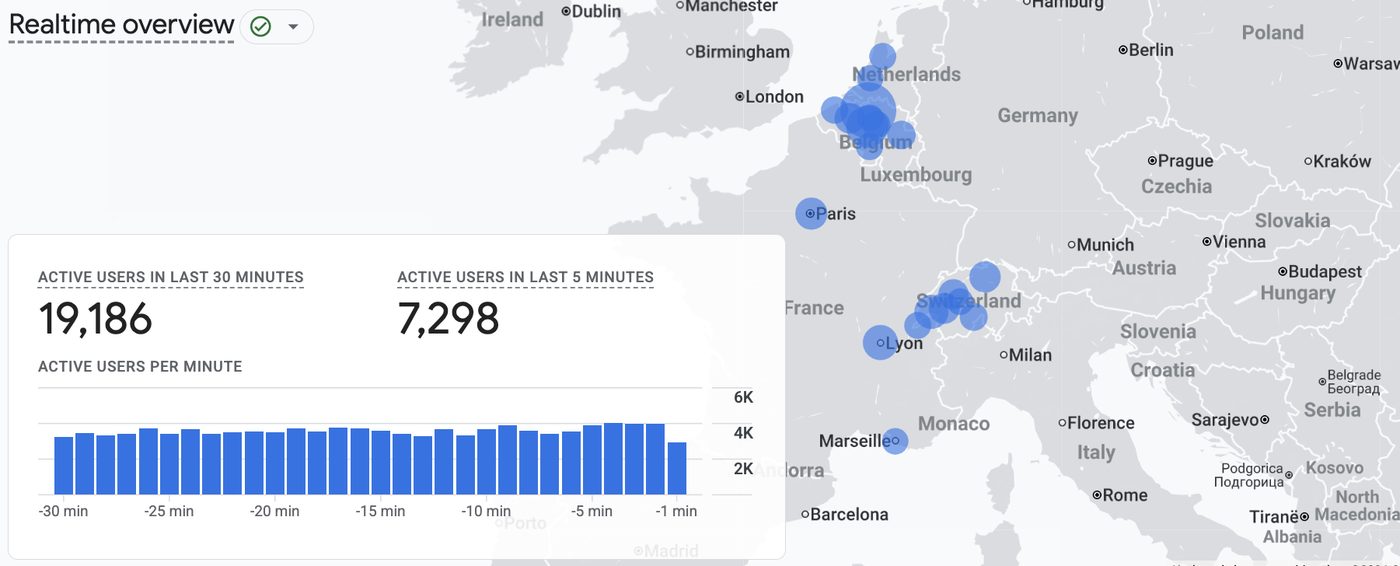
On the day of the eclipse, around 300,000 people used Sunset Atlas. In the half hour before 18:15 alone, more than 19,000 people opened the map.
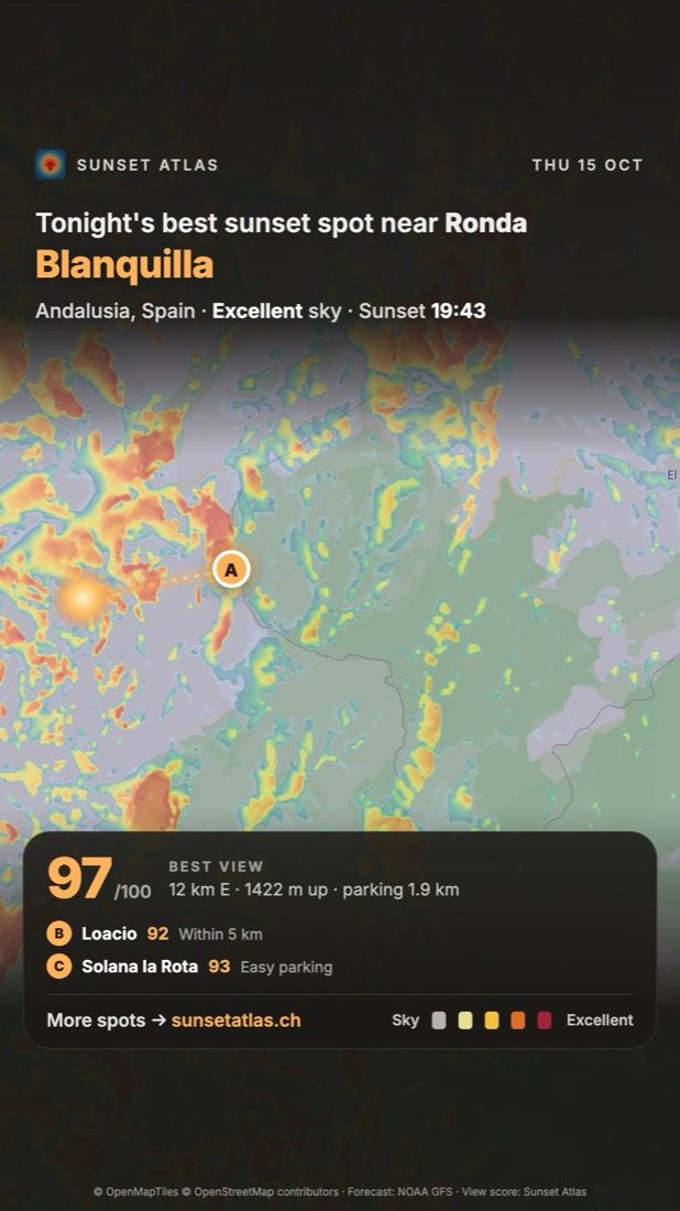
An eclipse only happens once, but there's a sunset every day. What I'm working on now is Instagram. A script reads the forecast every morning, picks the places where the sky should light up, and makes stories straight from the map. I also post “forecast checks”: what we predicted for a place, followed by a time-lapse of how the sunset actually turned out. Those videos are put together and published automatically too.